

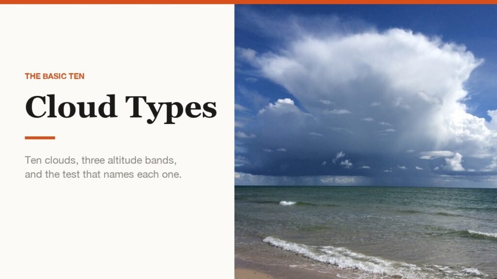
There are ten basic cloud types, and they are sorted into three divisions by the altitude at which they form. High clouds sit above 20,000 feet, middle clouds between 6,500 and 20,000, and low clouds below 6,500. Everything else you will ever see overhead is a variation on those ten.
The names are built from the same handful of Latin roots, so once the pattern is clear the chart reads itself. Below is each type with its altitude band, what it looks like, which ones bring rain, and the pairs that catch people out.
The Ten Cloud Types at a Glance
The two-letter abbreviation in the second column is the one used on aviation and marine weather reports, where there is no room for the full name.
| Cloud type | Code | Level | What it looks like |
|---|---|---|---|
| Cirrus | Ci | High | Thin white filaments of ice crystals, barely dimming the sun |
| Cirrocumulus | Cc | High | A patchy sheet of small white grains or ripples, no shading |
| Cirrostratus | Cs | High | A transparent whitish veil that usually puts a halo round the sun |
| Altocumulus | Ac | Middle | White or grey rounded masses and rolls, often in several layers |
| Altostratus | As | Middle | A grey striated sheet that shows the sun as through ground glass |
| Nimbostratus | Ns | Middle | A dark grey layer diffused by falling rain or snow |
| Cumulus | Cu | Low | Detached heaps with sharp outlines and bulging cauliflower tops |
| Cumulonimbus | Cb | Low | A dense tower, usually flattened into an anvil at the top |
| Stratocumulus | Sc | Low | Grey rolls or masses in a honeycomb pattern, rarely fibrous |
| Stratus | St | Low | A uniform grey layer with a clearly discernible sun behind it |
Read the names and the system appears. Cirro means high and wispy, alto means middle, strato means a flat layer, cumulo means a heap, and nimbo or nimbus means it is raining. Combine two roots and you have described the cloud: altostratus is a mid-level sheet, cumulonimbus is a raining heap.
The Three Altitude Bands
The divisions are not arbitrary. They track what the cloud is made of, because temperature falls with height and water stops being liquid somewhere along the way.
| Band | Altitude | Types | Composition |
|---|---|---|---|
| High | Above 20,000 feet | Cirrus, Cirrocumulus, Cirrostratus | Almost entirely ice crystals |
| Middle | 6,500 to 20,000 feet | Altocumulus, Altostratus, Nimbostratus | Mostly water droplets, ice when cold enough |
| Low | Below 6,500 feet | Cumulus, Cumulonimbus, Stratocumulus, Stratus | Water droplets |
Those figures are the standard mid-latitude bands. The boundaries sit lower towards the poles and higher over the tropics, because the whole troposphere is shallower in cold air and deeper in warm, so a cirrus cloud over Alaska can be thousands of feet lower than one over the equator.
High Clouds Above 20,000 Feet
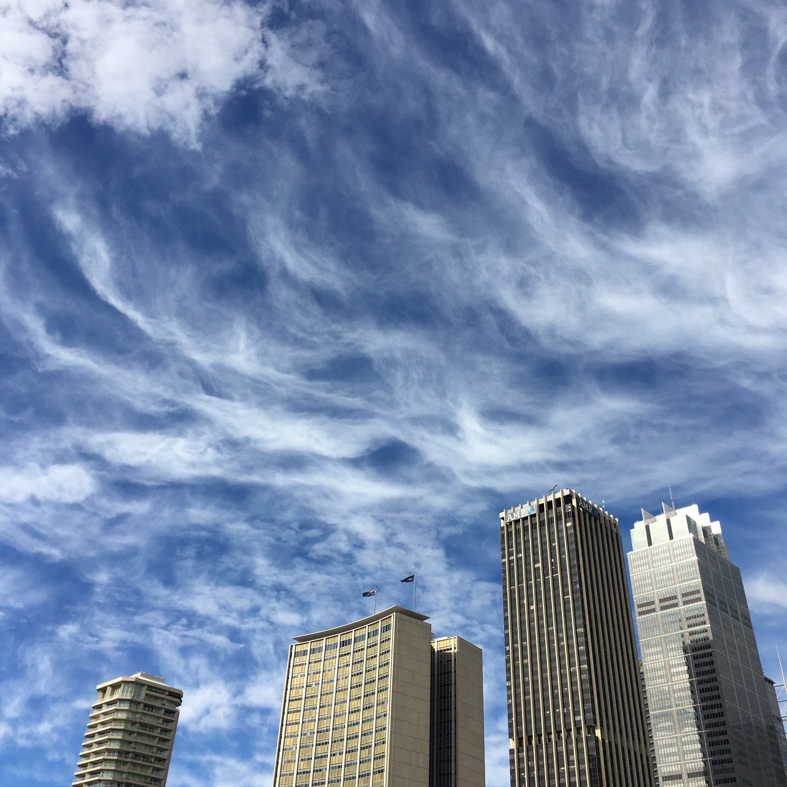
High clouds are made almost entirely of ice crystals, which is why they are thin, white and do very little to the light passing through them.
- Cirrus is composed of ice crystals throughout, and how transparent it looks depends on how far apart those crystals are. Crossing the sun it barely dims it at all.
- Cirrocumulus is a patchy sheet arranged into grains or ripples with no shading, each element narrower than a little finger held at arm’s length.
- Cirrostratus is a veil that can cover the whole sky and is never thick enough to stop objects casting shadows on the ground.
- The halo is the giveaway. Cirrostratus nearly always produces a halo around the sun or moon, which separates it from a thin low layer that looks similar.
Cirrus is also the first cloud lit at dawn and the last still lit at dusk, turning yellow or red long before and long after everything lower has gone grey. Near the horizon it often looks yellowish at any hour, because the light reaching it has travelled further through the atmosphere.
Middle Clouds, 6,500 to 20,000 Feet
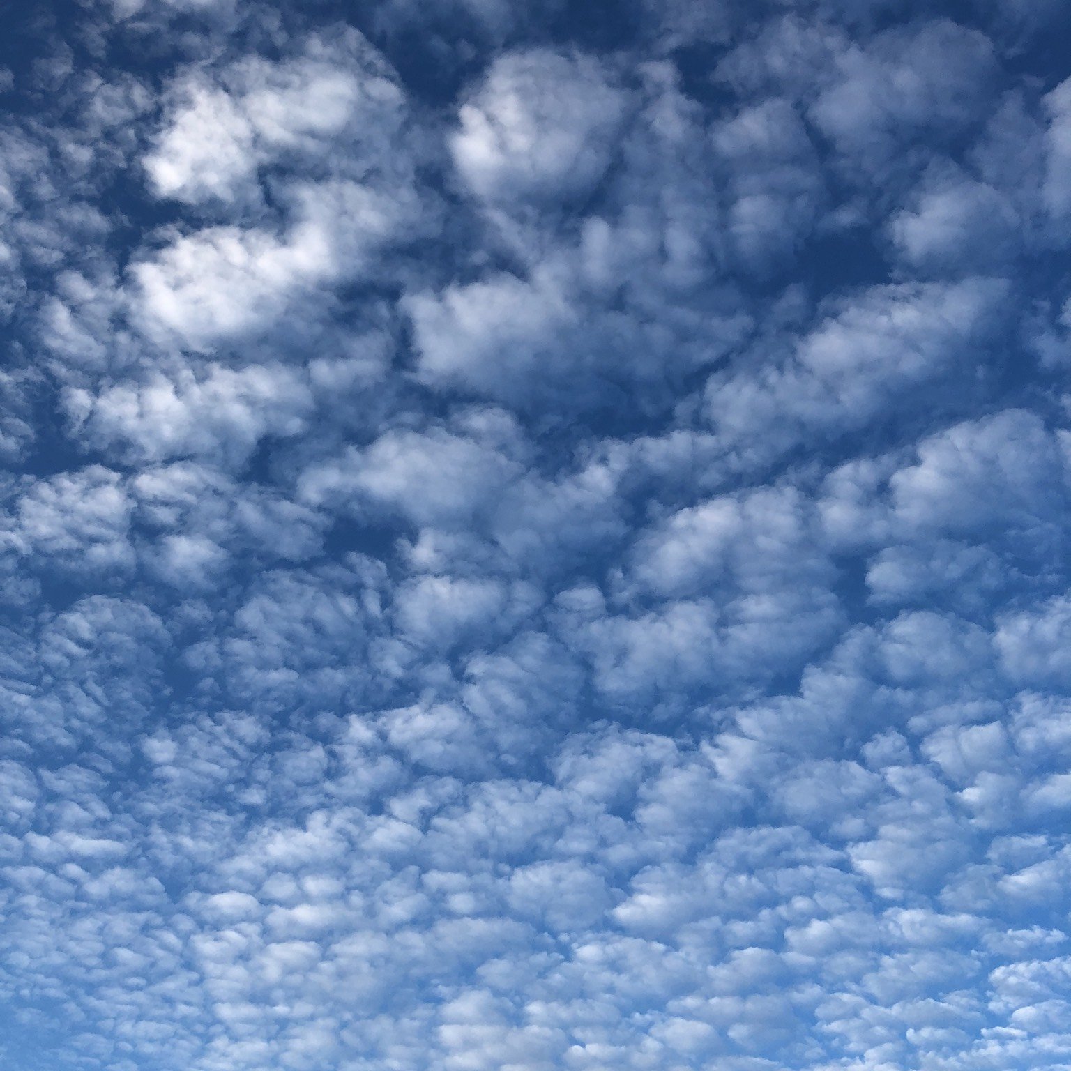
Middle clouds are mostly water droplets, and they are where the sky starts to tell you something is coming. Alto means high in Latin, which is confusing, and it is used here only to distinguish these from their low-level counterparts.
- Altocumulus is the most common mid-level cloud, often appearing in several layers at once. Its elements run one to five degrees across, which is wider than a little finger and narrower than three fingers at arm’s length.
- Altostratus is a grey or bluish sheet thin enough to show the sun as if through ground glass. It casts no visible shadows and produces no halo.
- Nimbostratus is what altostratus becomes when it thickens: a dark layer, diffused by falling rain or snow, thick enough to blot the sun out entirely.
- A corona means altocumulus. When a thin patch passes the sun or moon it produces a coloured ring with red outside and blue inside, within a few degrees of the disc.
Nimbostratus is the one most often misfiled. Its base lowers as the rain continues, so it ends up looking like a low cloud and gets called one, while both it and altostratus can reach up into the high level at the top.
Low Clouds Below 6,500 Feet
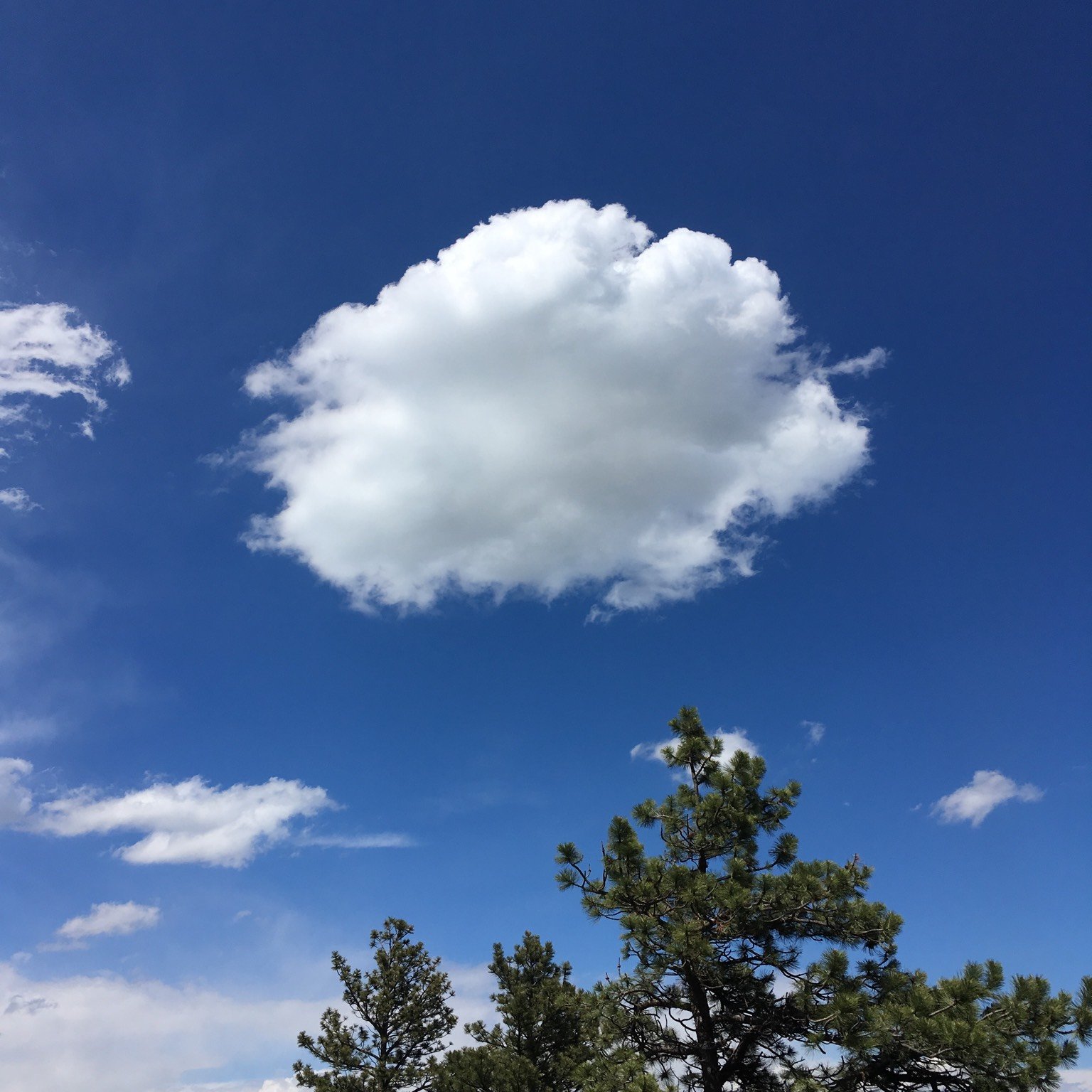
Low clouds are water droplets and they are the ones that dominate an ordinary sky. Two of the four are flat layers and two are heaps.
- Cumulus is the detached, sharp-edged heap with a cauliflower top, brilliant white where the sun hits and dark and flat underneath. Over land it builds through the morning on a clear day and mostly dissolves again by evening.
- Cumulonimbus is the thunderstorm cloud: a dense mountain or tower with a smoothed, fibrous top usually flattened into an anvil.
- Stratocumulus is grey or whitish rolls and masses with a honeycomb look, whose elements are more than five degrees across.
- Stratus is a uniform grey layer with a base low enough to look featureless, and the sun behind it keeps a clearly discernible outline.
Cumulonimbus is classified low because its base is low, not because the cloud is. Its updraft carries it well into the high level, and a mature storm cloud can span all three bands at once.
Which Clouds Actually Produce Rain
Only three of the ten are serious rain producers, and they reach the ground in completely different ways.
| Cloud type | What falls | What it grows from |
|---|---|---|
| Cumulonimbus | Heavy, and hail and tornadoes | A tall convective tower |
| Nimbostratus | Steady rain or snow for hours | A thickening altostratus layer |
| Cumulus | Showers once it grows tall enough | Daytime heating over land |
| Altostratus | Virga, sometimes light rain at the ground | A mid-level sheet |
| Stratus | Drizzle, ice prisms or snow grains | A thick low layer |
| Cirrus and Cirrocumulus | None that reaches the ground | Ice crystals far too high |
Cumulonimbus is also the only one of the ten that produces hail and tornadoes. Beneath its base, which is often very dark, low ragged clouds commonly form and may or may not merge with it.
Virga is worth recognising: streaks of precipitation that hang below a cloud and evaporate before reaching the ground. It appears under altostratus and under cumulonimbus, and it is the reason a sky can look like it is raining while nothing arrives.
Telling the Similar Ones Apart
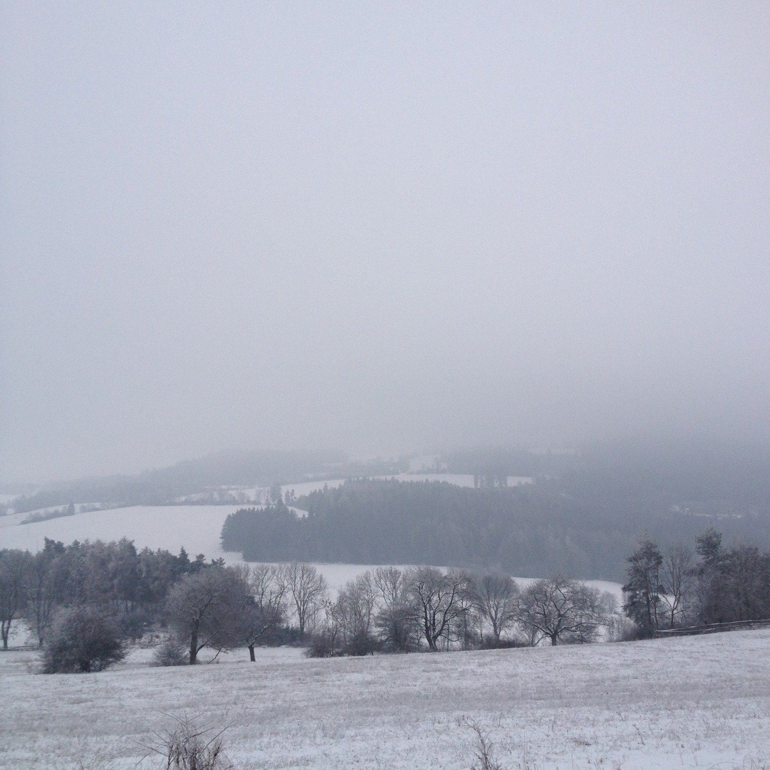
Four pairs account for most misidentifications, and in each case there is one reliable test that does not depend on judging height.
- Cirrostratus against altostratus. Cirrostratus produces a halo and lets objects cast shadows. Altostratus does neither.
- Cirrocumulus against altocumulus against stratocumulus. Measure one element against your hand at arm’s length: under a little finger is cirrocumulus, up to three fingers is altocumulus, wider than that is stratocumulus.
- Stratus against fog. The same cloud. Fog is stratus whose base has reached the ground.
- Altostratus against nimbostratus. If the sun is still visible at all, it is altostratus. Nimbostratus blots it out completely.
Height itself is the hardest thing to judge by eye and the least useful test. Every one of the checks above works from the ground with no equipment, which is also how a forecast app earns its keep by filling in what the sky will not tell you, as our picks for the best weather apps set out.
Beyond the Ten: Species, Varieties and Features
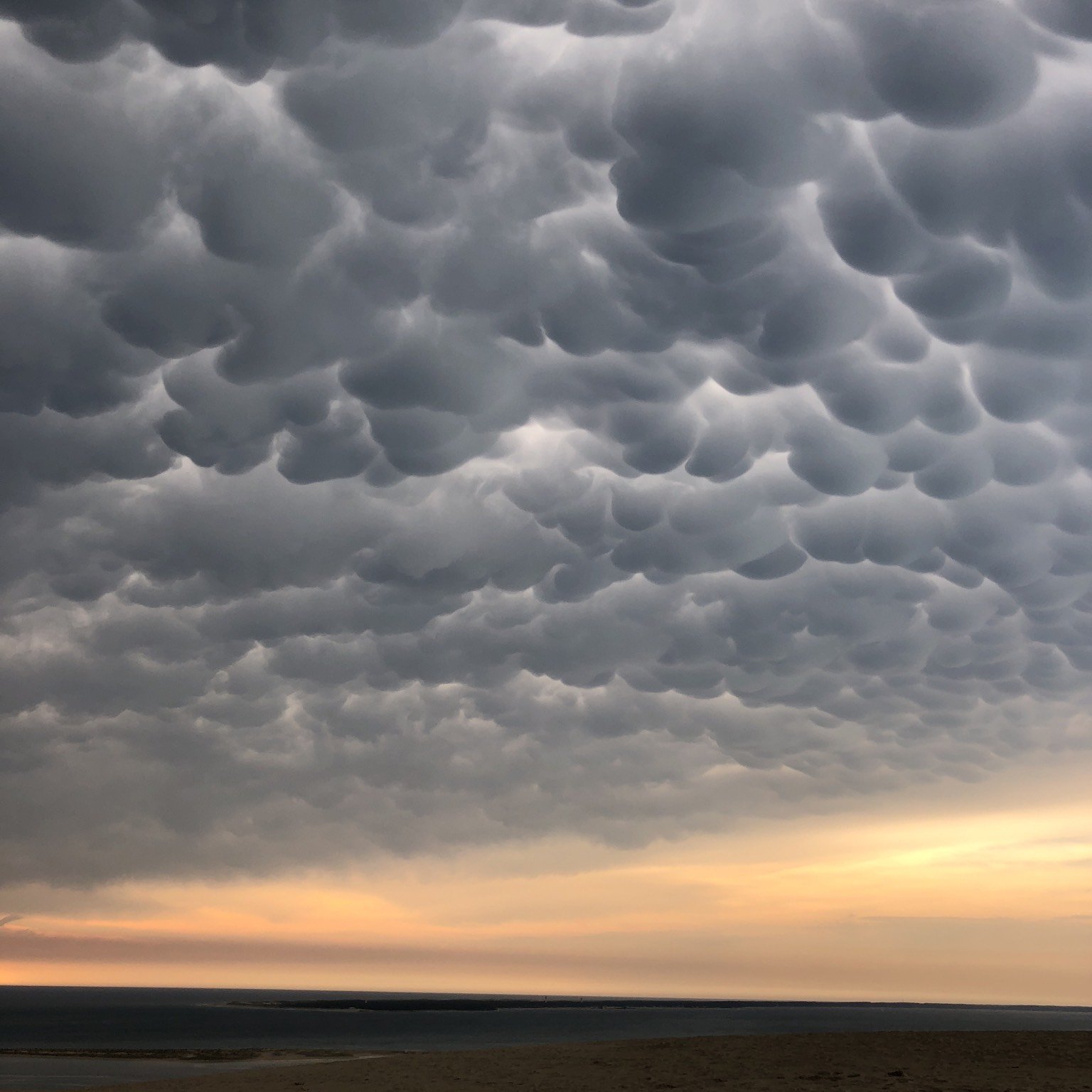
The ten basic types are the top level of a larger scheme. They are subdivided into 27 classifications, many of which describe the same basic cloud at a different stage of development, opacity or sky cover.
- Mammatus are the pouches that hang beneath a cloud base, most often under the anvil of a cumulonimbus.
- Lenticularis are the smooth lens shapes that form in the standing wave downwind of a hill or mountain.
- Arcus is the shelf or roll along the leading edge of a storm.
- Contrails are condensation trails from aircraft exhaust, and they can spread into a sheet indistinguishable from natural cirrus.
- Fractus are the low ragged shreds that form beneath a raining cloud base.
Contrails sit in the high band by definition. They form in the same cold ice-crystal air as cirrus, because that is the air a long-haul jet such as the Airbus A380 spends its cruise in.
Frequently Asked Questions
What are the ten cloud types?
Cirrus, cirrocumulus and cirrostratus are the high clouds. Altocumulus, altostratus and nimbostratus are the middle clouds. Cumulus, cumulonimbus, stratocumulus and stratus are the low clouds.
Which cloud type means rain is coming?
Nimbostratus for steady rain and cumulonimbus for storms. A thickening sequence of cirrus, then cirrostratus, then altostratus is the classic approach of a warm front, with nimbostratus at the end of it.
What is the difference between stratus and fog?
Height alone. Fog is a stratus cloud whose base has reached ground level, and the two are the same phenomenon.
How high is a cumulonimbus cloud?
It is classified as a low cloud because its base is below 6,500 feet, but its updraft carries the top well into the high level, so a mature storm cloud occupies all three altitude bands at once.
Related Articles

Get the Fox Bulletin briefing
The stories that matter, in your inbox. No spam, unsubscribe anytime.
Newsletter signup will be available soon.
Related stories

Military Ranks: Every Pay Grade in All Six Branches
Every US military rank by pay grade, across the Army, Marine Corps, Navy, Air Force, Space Force and Coast Guard, and the title traps that catch people out.
Ring Size Chart: Every US Size in Millimetres
Every US ring size from 3 to 13 with its inside diameter and circumference, two ways to measure at home, and the reasons the same finger measures differently.

Birth Flowers by Month: All 12 and What They Mean
Every month has a birth flower, and most have two. Here are all twelve photographed, the meanings attached to them, and why the pairings were never standardised.